
Anna Ruby Falls
On-site & Nearby Trails
Explore Waterfall Trails, Creekside Paths, and North Georgia Mountain Hikes
Anna Ruby Falls offers two short paved trails near the visitor center, along with a longer natural-surface trail connecting the recreation area with Unicoi State Park. The on-site trails are the best place to begin if you want to walk beside Smith Creek, view the twin waterfalls, or enjoy a shorter forest experience close to the visitor center. Visitors looking for a longer outing can add nearby waterfall hikes, lakeside walks, or more strenuous summit trails throughout the Helen and North Georgia area.
Trail mileage below uses published figures and estimates where available. Hiking times are general planning estimates and may vary based on pace, weather, trail conditions, parking, and time spent at overlooks. Published distances can also vary slightly by map, route, or turnaround point, so mileages should be used as planning estimates.
On-Site Trails at Anna Ruby Falls
Anna Ruby Falls Trail
Length: Approximately 0.8 mile round trip
Difficulty: Short but moderately strenuous because of steep sections
Surface: Paved trail with outdoor forest conditions
Trailhead Location: Near the visitor center
Estimated Time: 45–75 minutes, including time at the observation decks
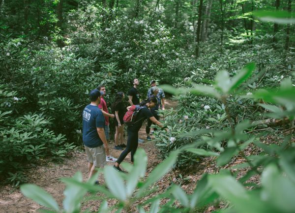
The main Anna Ruby Falls Trail follows Smith Creek approximately 0.4 miles from the visitor center to the upper and lower observation decks. Along the way, visitors can enjoy rushing water, smaller cascades, shaded forest scenery, and benches where they can pause and rest.
Although the trail is relatively short and paved, it includes steep grades and may feel more challenging than the distance suggests. Visitors should take their time, wear comfortable walking shoes, and use extra caution when the pavement is wet, covered with leaves, or crowded.
At the end of the trail, the observation areas provide close views of the two waterfalls that give Anna Ruby Falls its distinctive appearance. Curtis Creek drops approximately 153 feet, while York Creek falls approximately 50 feet. The two streams meet at the base of the falls to form Smith Creek.
Visitors should remain on designated trails and observation decks. Swimming, wading, entering the creek, fishing, climbing around the falls, and going off trail are not allowed.
Lion’s Eye Trail
Length: Approximately 0.1 mile
Difficulty: Short and gentle, with variable outdoor conditions
Surface: Paved interpretive trail
Trailhead Location: Near the visitor center
Estimated Time: 10–20 minutes
Located near the visitor center, the Lion’s Eye Trail is a short paved trail dedicated in 1987 through a partnership between the Chattahoochee National Forest, local Lions Clubs, volunteers, and community supporters.
The trail follows Smith Creek through a quiet forest setting and includes interpretive signs in standard text and braille, along with a cable handrail. While it does not lead to the waterfalls themselves, the Lion’s Eye Trail offers a peaceful walk beside the creek and a way to experience the forest without navigating the steeper grades of the main Anna Ruby Falls Trail.
The Lion’s Eye Trail is the primary on-site trail option for visitors using wheelchairs, scooters, walkers, or other mobility devices. Because it remains an outdoor forest trail, conditions may still vary due to rain, leaves, moisture, debris, maintenance, and natural wear.
On-Site Trail and Mobility
Note: The main Anna Ruby Falls Trail is paved, but its steep grades make it unsuitable for wheelchairs, scooters, and other mobility assistance devices. Strollers are permitted at the visitor’s own risk, but the grade and weight of a stroller can make both the climb and descent difficult.
Visitors looking for a shorter route with gentler grades should consider the Lion’s Eye Trail. Conditions on all outdoor trails can change with weather, maintenance, moisture, leaves, debris, and natural wear.
Nearby Trails Worth Adding to Your Visit
Note: Nearby trails are for informational purposes only and are not associated with, managed or maintained by FIND Outdoors
Smith Creek Trail
Length: Approximately 4.6 miles one way
Difficulty: Moderate to strenuous
Surface: Natural forest trail with roots, rocks, mud, and elevation changes
Trailhead Location: Branches from the Anna Ruby Falls Trail near the upper bridge
Estimated Time: Several hours; a full out-and-back may take much of the day
The Smith Creek Trail connects the Anna Ruby Falls area with the campground in Unicoi State Park. This longer, unpaved trail offers a quieter forest experience but is not maintained by Anna Ruby Staff and should not be treated as a simple extension of the short waterfall walk.
Hikers should review the full route, weather, daylight, and transportation plan before starting. An out-and-back hike can total approximately 9.2 miles, and the Anna Ruby Falls entrance gate closes at the end of each operating day.
Visitors planning to hike the full Smith Creek Trail should not leave a vehicle inside the Anna Ruby Falls gate. The route can take longer than expected, and vehicles remaining after closing will be locked inside the recreation area. Both Anna Ruby and Unicoi State Park staff cannot provide trail pickups for hikers who become tired, encounter wildlife, lose daylight, or do not complete the route before the gate closes. Starting from Unicoi State Park or arranging transportation may be a better option for some hiking plans.
Unicoi Lake Trail
Length: About 2 miles, depending on the selected route
Difficulty: Easy to moderate
Surface: Natural trail with lakeside paths, wooded sections, and occasional wet areas
Trailhead Location: Unicoi State Park
Estimated Time: 45–90 minutes
The Unicoi Lake area is one of the closest options for visitors who want an additional walk without committing to a steep mountain climb. The trail offers forest and lake scenery and can be a relaxing addition before or after visiting Anna Ruby Falls.
Unicoi State Park is managed separately and may have its own parking fees, rules, and operating information. Visitors should review the current park map and choose a route that fits their available time and comfort level.
Dukes Creek Falls Trail
Length: Approximately 2 miles round trip
Difficulty: Moderate
Surface: Paved beginning followed by steps and natural trail surfaces
Trailhead Location: Dukes Creek Falls Recreation Area along the Russell–Brasstown Scenic Highway
Estimated Time: 1–2 hours
Dukes Creek Falls is a popular nearby choice for visitors who want another waterfall experience. The trail begins with a short paved section and overlook before descending through the forest toward several viewing platforms near the falls.
The return hike requires climbing back uphill, so visitors should not assume the downhill walk represents the full level of effort. Expect steps, roots, moisture, and changing natural surfaces. Stay on the established trail and enjoy the waterfalls from designated viewing areas rather than approaching wet rocks or moving water.
The recreation area is a separate fee site, and potable water may not be available, so visitors should bring water and check current Forest Service information before arriving.
Brasstown Bald Summit Trail
Length: Approximately 1.2 miles round trip
Difficulty: Moderate to somewhat strenuous due to steep grade
Surface: Paved mountain trail
Trailhead Location: Brasstown Bald parking area
Estimated Time: 45–90 minutes
Brasstown Bald offers a different type of North Georgia trail experience at the highest point in Georgia. The paved Summit Trail climbs approximately 0.6 mile from the parking area to the visitor center and observation deck.
Although short, the route is very steep and should not be mistaken for an easy walk. A shuttle is generally offered as an alternative during visitor center operating hours, but availability and schedules may change.
On clear days, the observation deck offers wide mountain views across the surrounding region. Brasstown Bald has separate admission, seasonal operating information, and visitor rules, so check current details before traveling.
High Shoals Falls and Blue Hole Falls Trail
Length: Approximately 2.4 miles round trip to visit both waterfalls
Difficulty: Moderate
Surface: Natural mountain trail with roots, rocks, grades, and possible mud
Trailhead Location: High Shoals Scenic Area off Forest Service Road 283
Estimated Time: 1.5–2.5 hours
This forest trail leads to observation areas near both Blue Hole Falls and High Shoals Falls. Blue Hole Falls is reached first, followed by a continued descent toward the larger High Shoals Falls.
Because much of the trail descends on the way to the waterfalls, visitors should save enough time and energy for the uphill return. Conditions can be muddy or slippery after rain, and access-road conditions may vary. Check current weather and Forest Service information before making the drive.
Remain on the established trail and observation areas. Rocks near waterfalls can be extremely slippery, and moving water may be stronger than it appears.
Raven Cliff Falls Trail
Length: About 5–6 miles round trip, depending on the map and turnaround point used
Difficulty: Moderate, with more rugged conditions near the far end
Surface: Natural forest trail with roots, rocks, mud, and creekside terrain
Trailhead Location: Raven Cliff Falls trailhead off the Russell–Brasstown Scenic Highway
Estimated Time: 2.5–4 hours
Raven Cliff Falls Trail follows Dodd Creek through a shaded valley filled with cascades, smaller waterfalls, rock formations, and dense forest scenery. It is a strong option for visitors who want a longer waterfall-focused hike after experiencing Anna Ruby Falls.
The trail becomes rougher near its far end, and informal paths around the cliff may be steep or hazardous. Visitors should stay on the established route, avoid scrambling near cliffs or wet rocks, and turn around if conditions exceed their experience or comfort level.
Parking can be limited during weekends and peak seasons. Arrive with enough daylight, bring water, and save the route offline before leaving.
Yonah Mountain Trail
Length: Approximately 4.4–4.6 miles round trip
Difficulty: Strenuous
Surface: Natural mountain trail with sustained climbing, rocks, roots, and steep sections
Trailhead Location: Chambers Road near Cleveland and Helen
Estimated Time: 3–5 hours
Yonah Mountain Trail is a challenging summit hike for prepared visitors looking for a more strenuous North Georgia outing. The trail gains roughly 1,400 feet as it climbs toward the mountain’s upper areas and open summit meadow.
The route involves a long, sustained climb and should not be treated as a quick add-on to a waterfall visit. Visitors should bring plenty of water, wear appropriate footwear, and allow enough daylight for the full hike.
Cliffs and steep drop-offs are present near upper areas of the mountain. Stay on the established trail, remain well back from edges, and follow any posted closures or restrictions related to weather, maintenance, or military training activity.
Choosing the Right Trail for Your Visit
For the shortest on-site walk, consider the Lion’s Eye Trail. For the classic Anna Ruby Falls experience, follow the paved main trail to the observation decks, keeping in mind that the route includes steep grades.
Visitors looking for another nearby but manageable outing may enjoy the Unicoi Lake Trail or Dukes Creek Falls. High Shoals and Blue Hole Falls offer a longer natural-surface waterfall hike, while Raven Cliff Falls provides several miles of creek-side scenery.
Nearby Brasstown Bald offers a short but steep summit route, and Yonah Mountain is best for hikers prepared for a sustained climb. Smith Creek Trail is also a substantial outing that requires careful planning around distance, transportation, daylight, and the Anna Ruby Falls gate-closing time.
Trail, road, and parking conditions can change quickly in the mountains. Before heading to another trail, check current weather and managing-agency alerts, save directions and maps offline, bring water, and select a route that fits your group’s experience, time, and energy level.
→ View the North Georgia Waterfalls Guide
→ Check Chattahoochee-Oconee National Forest Alerts
→ Explore Unicoi State Park