
Brasstown Bald

On-site & Nearby Trails

Explore Summit Paths, Mountain Trails, and North Georgia Hikes

Brasstown Bald offers several ways to explore Georgia’s highest point. Visitors can follow the short but steep paved trail to the summit, choose a longer natural-surface route into the surrounding mountains, or add a nearby waterfall or forest hike to their North Georgia visit.

The trails beginning at Brasstown Bald range from a paved summit trail to several more strenuous routes that may require more time, careful navigation, and transportation planning.

Trail mileage below uses published figures where available. Hiking times are general planning estimates and may vary based on pace, weather, elevation, trail conditions, rest stops, parking, and time spent at overlooks. Published distances may also vary slightly by map, route, or turnaround point.
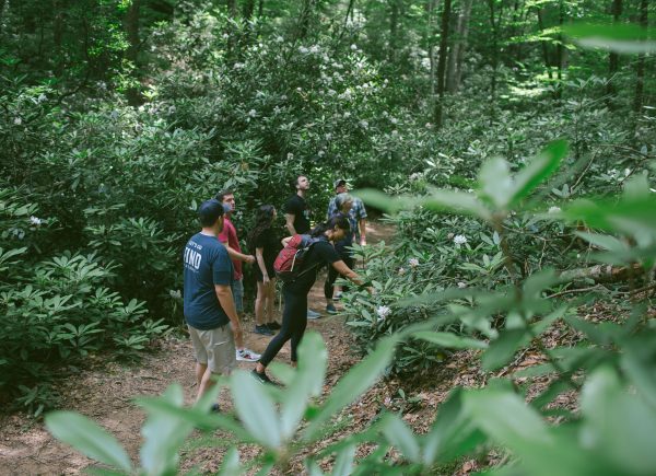
CreativeTEAMDAY
Trails Beginning at Brasstown Bald
Summit Trail
Length: Approximately 0.6 miles one way
Difficulty: Short but strenuous due to steep grade
Surface: Paved
Trailhead Location: Main Brasstown Bald parking area
Estimated Time: 45–90 minutes round trip, including time at the summit
The Summit Trail is the main walking path from the parking area to the observation deck and mountaintop visitor center. Although the trail is paved and relatively short, it climbs steeply throughout much of the route and should not be mistaken for an easy or level walk.
Visitors should take their time, wear comfortable walking shoes, and use caution when the pavement is wet, icy, covered with natural debris, or crowded. Benches along the route provide places to pause during the climb.
During staffed operating hours, the seasonal shuttle offers an alternative to walking. Outside regular visitor-service hours, visitors should expect no shuttle service and no outdoor lighting along the trail. Bring a dependable flashlight when visiting before sunrise or after dark.
Jack’s Knob Trail
Length: Approximately 4.5 miles to the Appalachian Trail connection
Difficulty: Strenuous
Surface: Natural mountain trail with roots, rocks, grades, and changing terrain
Trailhead Location: Near the Brasstown Bald parking area
Estimated Time: Several hours one way
Jack’s Knob Trail connects the Brasstown Bald area with Chattahoochee Gap on the Appalachian Trail. The route descends through a series of switchbacks, crosses GA-180 at Jacks Gap, and then climbs toward the Appalachian Trail.
This is a substantial mountain hike rather than a short extension of the summit visit. Hikers should decide before starting whether they will retrace the route to Brasstown Bald, continue onto another trail, or arrange transportation from a different location.
Returning by the same route creates a much longer outing with considerable elevation change. Review current maps, weather, daylight, and transportation needs before beginning.
Arkaquah Trail
Length: Approximately 5.5 miles one way
Difficulty: Strenuous
Surface: Natural wilderness trail with roots, rocks, steep grades, and uneven terrain
Trailhead Location: Near the Brasstown Bald parking area
Estimated Time: Several hours one way
Arkaquah Trail travels between Brasstown Bald and Track Rock Gap. Much of the route passes through the Brasstown Wilderness, following mountain ridges with repeated climbs, descents, and occasional long-range views.
The trail ends away from the Brasstown Bald visitor area and should not be treated as an out-and-back addition to a regular summit visit. Hikers traveling one way must arrange a second vehicle or other transportation before starting.
Those planning to return to Brasstown Bald on foot should prepare for a long, strenuous hike with a significant uphill climb. Bring adequate water, food, navigation tools, weather-appropriate clothing, and enough daylight to complete the route.
Wagon Train Trail
Length: Approximately 7 miles
Difficulty: Moderate to strenuous
Surface: Natural trail with sections following an old roadbed
Trailhead Location: Connects with the Summit Trail area
Estimated Time: Several hours
Wagon Train Trail is the longest trail beginning at Brasstown Bald. Following a route connected to the mountain’s earlier travel and access history, it leads away from the developed summit area and into the surrounding forest. 
This trail should be planned as a longer mountain outing rather than a short summit walk. Before beginning, review a current Forest Service map, select a turnaround point, and understand how you will return to the Brasstown Bald parking area.
Conditions may include roots, rocks, mud, fallen leaves, elevation changes, and limited cellular service. Bring enough water, food, navigation equipment, and daylight for the route you choose.
 On-Site Trail and Mobility Note
Although the Summit Trail is paved, its steep and sustained grade makes it unsuitable for wheelchairs, scooters, walkers, canes, and similar mobility devices. Visitors using mobility devices, or anyone unable to comfortably manage the trail’s steep grade, should plan to use the seasonal shuttle during staffed operating hours rather than attempting the climb. 
Shuttle service, elevator access, and other accessibility features may be affected by weather, maintenance, staffing, or changing site conditions. Visitors with mobility needs should review current accessibility information or contact Brasstown Bald before arriving.
The longer trails beginning at Brasstown Bald have natural surfaces, uneven footing, roots, rocks, and significant elevation changes. These routes are not developed and should not be treated as accessibility paths or alternatives to the shuttle. 
Nearby Trails Worth Adding to Your Visit
Note: Nearby trails are for informational purposes only and are not associated with, managed or maintained by FIND Outdoors
Bear Hair Gap Trail
Length: Approximately 4.1 miles
Difficulty: Moderate
Surface: Natural forest trail
Trailhead Location: Vogel State Park
Estimated Time: About 2 hours
Bear Hair Gap Trail offers a partial-loop hike through the mountains surrounding Vogel State Park. The trail climbs across the lower ridges of Blood Mountain and may provide seasonal views when leaves are down.
Parts of the route travel outside the state park and onto the Chattahoochee National Forest. Portions beyond the park may be open to hunting, so hikers should review current notices and consider wearing brightly colored clothing during hunting seasons.
Vogel State Park has separate parking requirements, rules, and operating information. Check current park conditions before arriving.
Dukes Creek Falls Trail
Length: Approximately 1.25 miles one way to the lower observation area
Difficulty: Moderate
Surface: Developed trail including steps and sections of natural terrain 
Trailhead Location: Dukes Creek Falls Recreation Area
Estimated Time: 1.5–3 hours round trip
Dukes Creek Falls is a strong nearby choice for visitors who want a waterfall experience. The trail begins near the parking area and continues toward several observation decks overlooking the falls and surrounding forest.
The route descends toward the viewing areas, which means visitors must climb uphill on the return. Expect steps, roots, moisture, and changing trail surfaces beyond the shorter upper overlook.
Dukes Creek Falls is a separate U.S. Forest Service recreation area with its own day-use fee and operating information. Please review the current site and conditions of Dukes Creek Falls before traveling.
Helton Creek Falls Trail
Length: Approximately 0.2 mile
Difficulty: Short, with sudden changes in grade
Surface: Natural forest trail
Trailhead Location: Helton Creek Falls area near Blairsville
Estimated Time: Usually less than one hour on site
Helton Creek Falls is a useful option for visitors looking for a short waterfall stop rather than another full hiking day. The brief trail leads to views of two waterfalls within the Chattahoochee-Oconee National Forest.
Although short, the route includes changing grades and natural surfaces. Visitors should wear appropriate footwear, remain on the designated trail and observation area, and use caution near wet rocks, moving water and follow waterfall safety protocols.
The access road and parking area are less developed than those at Brasstown Bald. Review current road and site information before making the drive.
Raven Cliff Falls Trail
Length: Approximately 5.2 miles round trip
Difficulty: Moderate to strenuous
Surface: Natural trail with roots, rocks, mud, and creek crossings
Trailhead Location: Raven Cliff Wilderness trailhead along the Richard B. Russell Scenic Highway
Estimated Time: 3–4 hours
Raven Cliff Falls Trail follows Dodd Creek through a shaded forest with cascades, smaller waterfalls, and rock formations. The route offers a longer and more rugged waterfall-focused hike than Helton Creek or Dukes Creek Falls.
Visitors should expect changing natural surfaces, possible stream crossings, and wetter conditions especially after rain. The area has limited services, and cellular reception may be unreliable.
Bring adequate water, allow enough daylight, and save maps and directions before leaving. Remain on the established trail and avoid climbing near cliffs, waterfalls, or wet rocks.
Choosing the Right Trail for Your Visit
For the classic Brasstown Bald experience, choose the Summit Trail. It is the shortest route and leads directly to the observation deck and mountaintop visitor center, but its steep grade can make it more challenging than the distance suggests.
Jack’s Knob Trail provides a connection to the Appalachian Trail, while Arkaquah Trail travels between Brasstown Bald and Track Rock Gap. Both are strenuous routes requiring several hours and careful planning. Wagon Train Trail is another longer option best suited to visitors prepared with a current map, adequate supplies, and a clear return plan.
For a nearby loop hike, consider Bear Hair Gap Trail at Vogel State Park. Helton Creek Falls offers the shortest waterfall walk, while Dukes Creek Falls provides a longer developed route with an uphill return. Raven Cliff Falls is best for visitors prepared for several miles of more rugged forest terrain.
Before heading onto any trail, check current weather, road conditions, parking information, and managing-agency alerts. Save maps offline, bring water, allow enough daylight, and select a route that fits your group’s experience, available time, and energy level.
View Current Brasstown Bald Visitor Information 
→ Check Chattahoochee-Oconee National Forest Alerts 
→ Explore Georgia State Parks Trails