
Carolina Hemlocks
Nearby Trails
Explore Trails Around Burnsville and Yancey County
Carolina Hemlocks Campground & Recreation Area provides a convenient start for exploring hiking opportunities throughout Yancey County, Pisgah National Forest, and the surrounding Blue Ridge Mountains.
Visitors looking to add a hike to their stay can explore sections of the Appalachian Trail, high-elevation trails at Mount Mitchell State Park, and other routes throughout the region.
Trail mileage below uses published figures and estimates where available. Hiking times are general planning estimates and may vary based on pace, weather, trail conditions, parking, elevation, and time spent at overlooks. Published distances can also vary slightly by map, route, or turnaround point, so mileages should be used as planning estimates.
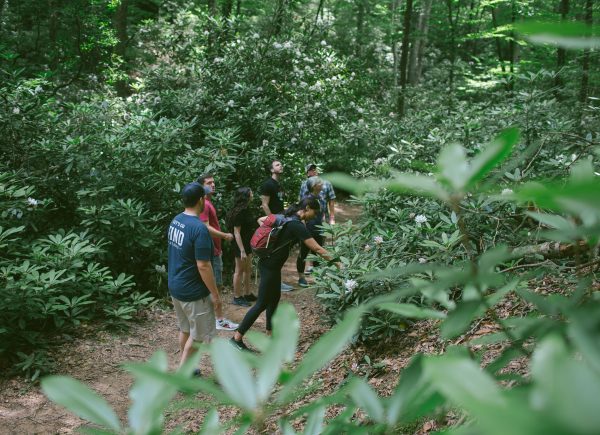
Nearby Trails Worth Adding to Your Visit
Note: Nearby trails are provided for informational purposes only and are not managed or maintained by FIND Outdoors. Trail and road conditions in the surrounding mountains can change because of weather, maintenance, storm recovery, or temporary closures. Always check current information from the managing agency before traveling to another trailhead.
Appalachian Trail: Spivey Gap to High Rocks
Length: Approximately 4 miles round trip
Difficulty: Moderate to strenuous
Surface: Natural mountain trail with roots, rocks, grades, and possible muddy sections
Trailhead Location: Spivey Gap along US-19W
Estimated Time: 2–3 hours
The Appalachian Trail at Spivey Gap provides one of the area’s most rewarding options for visitors looking for a moderate mountain hike with a scenic destination.
From Spivey Gap, the Appalachian Trail climbs through the forest toward High Rocks, a rocky viewpoint overlooking the surrounding mountains. The round-trip hike includes substantial elevation gain despite its relatively short distance, so hikers should be prepared for a steady climb.
Visitors should check current Appalachian Trail conditions before arriving and follow any posted signs or temporary instructions. Bring water, wear sturdy footwear, and allow extra time if trail surfaces are wet or muddy.
Balsam Nature Loop Trail
Length: Approximately 0.7 mile loop
Difficulty: Moderate
Surface: Natural high-elevation forest trail
Trailhead Location: Mount Mitchell State Park summit area
Estimated Time: 30–60 minutes
The Balsam Nature Loop offers a shorter hiking option within Mount Mitchell State Park and provides an opportunity to explore the high-elevation spruce-fir forest near the summit.
The trail loops through a dramatically different environment from the lower-elevation forest surrounding Carolina Hemlocks. Cooler temperatures, fog, wind, roots, rocks, and wet trail conditions are common at this elevation.
Although the route is short, visitors should wear appropriate footwear and consider an extra layer due to differing mountain temperatures.
Mount Mitchell State Park is managed separately from FIND Outdoors. Road access can also be affected by Blue Ridge Parkway closures, so visitors should check current park and Parkway information before beginning the drive.
Mount Mitchell to Mount Craig
Length: Approximately 2 miles round trip
Difficulty: Moderate to strenuous
Surface: Natural high-elevation trail with rocks, roots, climbing, and uneven terrain
Trailhead Location: Mount Mitchell State Park summit area
Estimated Time: 1.5–2.5 hours
Visitors looking for a more challenging summit-area hike can follow the Black Mountain Crest Trail from Mount Mitchell toward Mount Craig.
Mount Craig reaches approximately 6,647 feet and is the second-highest peak in the eastern United States. The route passes through high-elevation forest and includes rocky terrain, climbing, and sections that may require careful footing.
Weather at these elevations can change quickly. Fog, wind, rain, and temperatures considerably cooler than those at Carolina Hemlocks are possible, even during summer.
Hikers should bring water, wear sturdy footwear, stay on the established trail, and turn around if weather or trail conditions become uncomfortable.
Commissary Trail
Length: Approximately 2 miles one way
Difficulty: Easy
Surface: Natural mountain trail
Trailhead Location: Mount Mitchell State Park
Estimated Time: Approximately 1.5–3 hours depending on route and turnaround point
The Commissary Trail offers a longer forest walk within Mount Mitchell State Park without the sustained climbing found on some of the area’s more strenuous summit trails.
The trail travels through the high-elevation landscape surrounding Mount Mitchell and can be combined with other park trails depending on a visitor’s route, available time, and current trail conditions.
Visitors should review the Mount Mitchell State Park trail map before beginning, especially if connecting to another route. Mountain weather can change quickly, and hikers should carry water, appropriate clothing, and a saved or printed trail map.
Mount Mitchell Access Note
Mount Mitchell State Park is geographically close to Carolina Hemlocks, but possible road closures along the Blue Ridge Parkway can significantly affect driving routes and travel time.
Visitors should not rely only on the apparent distance shown on a map. Check current Blue Ridge Parkway and Mount Mitchell State Park access information before leaving Carolina Hemlocks.
Choosing the Right Trail for Your Visit
For a relatively short high-elevation walk, consider the Balsam Nature Loop at Mount Mitchell State Park.
Visitors looking for a moderate half-day outing with a scenic viewpoint may enjoy the Appalachian Trail from Spivey Gap to High Rocks.
For a more challenging high-elevation experience, the hike from Mount Mitchell toward Mount Craig provides rocky terrain, climbing, and access to one of the highest peaks in the eastern United States.
The Commissary Trail offers another option for visitors who want a longer forest walk while exploring Mount Mitchell State Park.
Trail and road conditions can change quickly in the mountains. Before heading to another trail, check current weather and managing-agency alerts, save directions and maps offline, bring enough water, and select a route that fits your group’s experience, available time, and energy level.
→ Explore Mount Mitchell State Park Trails
→ Check Pisgah National Forest Alerts
→ Check Blue Ridge Parkway Road & Trail Conditions