
Cliffside Lake & Van Hook Glade
Nearby Trails
Explore Trails Around Highlands
Van Hook Glade Campground & Cliffside Lake Recreation Area provides a convenient start for exploring hiking opportunities throughout Highlands, Pisgah National Forest, and the surrounding Blue Ridge Mountains.
Note: All of the on-site trails at Van Hook Glade and Cliffside Lake are natural-surface forest trails, with the exception of a short paved crossing at the Cliffside Lake dam. None are paved or graded for wheelchairs, scooters, or other mobility devices, and surfaces can include roots, rocks, and uneven or muddy ground.
Visitors seeking the most level, accessible on-site route should consider the Cliffside Loop Trail, which has the gentlest grade of the trail system, though it is still a natural surface. Conditions on all outdoor trails can change with weather, maintenance, moisture, leaves, debris, and natural wear.
Van Hook Trail
Length: Approximately 0.3 mile one way (site map); an additional 0.5-mile road walk connects to Cliffside Lake
Difficulty: Easy
Surface: Natural forest path
Trailhead Location: Van Hook Glade Campground
Estimated Time: 10–20 minutes
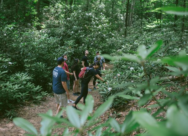
The Van Hook Trail is the short forest connector between Van Hook Glade Campground and the Cliffside Lake Recreation Area. It gives campers a walking option between the two sites instead of driving the access road, passing through quiet hardwood forest along the way. Because it is a connector rather than a destination trail, most visitors pair it with one of the loop trails at Cliffside Lake rather than walking it on its own.
Skitty Creek Trail
Length: Approximately 0.5 mile
Difficulty: Easy
Surface: Natural forest trail alongside the creek
Trailhead Location: Cliffside Lake Road, near the day use area
Estimated Time: 15–30 minutes
Skitty Creek Trail follows its namesake creek between Cliffside Lake Road and US 64, offering a shaded, easy walk through the forest. Near its far end the trail runs close to the highway, so visitors should keep an eye on children and pets and stay alert to road noise and traffic. The trail’s US 64 end connects to a short walk toward Dry Falls, making it a convenient link for visitors who want to combine a forest walk with a stop at the waterfall (see Dry Falls under Nearby Trails).
Clifftop Nature Trail
Length: Approximately 1 mile
Difficulty: Moderate, with a sustained climb
Surface: Natural forest trail
Trailhead Location: Cliffside Lake day use area, shared trailhead with Clifftop Vista Trail
Estimated Time: 30–50 minutes
Clifftop Nature Trail climbs through pine-hardwood forest toward a ridgetop above Cliffside Lake. Interpretive signage posted along the route highlights the forest’s plant life and history, making it a good option for visitors who want a short nature walk with some elevation gain.
The trail shares its lower section with the longer Clifftop Vista Trail, so watch for the point where the two routes split if you intend to keep this hike short.
Clifftop Vista Trail
Length: Approximately 1.6 miles
Difficulty: Moderate to strenuous, with sustained climbing
Surface: Natural forest trail with rocky, uneven sections
Trailhead Location: Cliffside Lake day use area, shared trailhead with Clifftop Nature Trail
Estimated Time: 45–75 minutes
Clifftop Vista Trail follows the same initial route as the Clifftop Nature Trail before continuing further, climbing through the Potts Memorial Plantation tract to a ridgetop gazebo. The gazebo offers panoramic mountain views and a good rest stop before the trail continues along the ridge.
Because it gains the most elevation of any on-site trail, visitors should wear sturdy footwear, carry water, and allow extra time. An unmarked, unmaintained path continues from this general area toward Ranger Falls; it is not an official trail and is described separately under Nearby Trails for hikers who want that added challenge.
Potts Memorial Trail
Length: Approximately 0.5 mile
Difficulty: Easy
Surface: Natural forest trail
Trailhead Location: Within the Potts Memorial Plantation tract, off the Clifftop trails
Estimated Time: 15–30 minutes
Potts Memorial Trail winds through a planted white pine plantation within the historic Potts Memorial Plantation tract. Its gentle grade and shaded canopy make it one of the easier on-site walks, offering a quieter, more sheltered alternative to the open ridge views along the Clifftop Vista Trail.
Cliffside Loop Trail
Length: Approximately 0.75 mile
Difficulty: Easy
Surface: Natural trail, with a paved crossing at the dam
Trailhead Location: Cliffside Lake day use area, near the beach and parking
Estimated Time: 20–40 minutes
Cliffside Loop Trail circles Cliffside Lake, passing along the swim beach, over the dam, and around the edge of the surrounding picnic and campground areas. It is one of the flattest, most accessible on-site routes and a popular choice for families or visitors who want lake views without a steep climb. Anglers often use sections of the loop to access fishing spots along the shoreline. As with all trails here, stay on the established path and be mindful of others enjoying the beach and picnic areas.
Homesite Road Trail
Length: Approximately 1.5 miles
Difficulty: Easy to moderate
Surface: Old roadbed and natural forest trail
Trailhead Location: Near the dam at Cliffside Lake
Estimated Time: 45–60 minutes
Homesite Road Trail follows an old roadbed alongside Skitty Creek, leading out to a road that meets US 64 between Dry Falls and Bridal Veil Falls. It is the longest of the on-site trails and offers a quieter, more secluded walk than the loops closer to the lake. Because it ends at a different point along US 64, some visitors combine it with the Skitty Creek Trail for a longer loop, or use it as a one-way route timed around a second vehicle or a short roadside walk back. Review the route before starting, since it is less traveled than the trails immediately around the lake.
Nearby Trails Worth Adding to Your Visit
Note: Nearby trails are provided for informational purposes only and are not managed or maintained by FIND Outdoors. Trail and road conditions in the surrounding mountains can change because of weather, maintenance, storm recovery, or temporary closures. Always check current information from the managing agency before traveling to another trailhead.
Dry Falls
Length: Approximately 0.2 mile round trip
Difficulty: Easy, with a steep paved switchback
Surface: Paved path that turns to dirt near the falls
Trailhead Location: Dry Falls parking area off US 64, Cullasaja Gorge
Estimated Time: 15–20 minutes
Dry Falls is a 75-foot waterfall on the Cullasaja River, reached by a short paved walkway that switchbacks down the slope before turning to dirt near the water. The path continues behind the curtain of falling water, giving visitors an up-close view without stepping into the creek. This is a separate U.S. Forest Service fee site and is not managed by FIND Outdoors. It draws heavy crowds at midday and on holidays, so early morning or evening visits are more peaceful. Wet rocks are slick, and visitors should stay on the walkway and avoid climbing or shortcutting near the falls.
Bridal Veil Falls
Length: A short roadside walk, well under 0.1 mile
Difficulty: Easy
Surface: Old paved roadbed
Trailhead Location: Pull-off on US 64, about 2.3 miles north of Highlands
Estimated Time: 10 minutes
Bridal Veil Falls is a 45-foot waterfall on a tributary of the Cullasaja River, framed by an overhanging bluff. The falls sit along a stretch of pavement that was once the main route of US 64; the road passed directly behind the falls before the highway was rerouted, and it is now open to pedestrians only. In lower water, visitors can walk behind the falls and stay mostly dry; in higher flow, expect to get wet. There is no fee, and the roadside parking area makes it an easy stop when combined with a visit to Dry Falls or the recreation area.
Glen Falls Trail
Length: Approximately 1.7 miles round trip to all three falls
Difficulty: Moderate, downhill on the way in and uphill on the return, about 500 feet of elevation change
Surface: Natural forest trail with rocky, root-covered sections and some steps
Trailhead Location: Glen Falls Trailhead off Forest Service roads southwest of Highlands, near NC 106
Estimated Time: 1–1.5 hours
Glen Falls Trail descends through a rhododendron-lined forest to three cascading waterfalls, with overlooks of the upper and middle falls along the way before reaching a sandy area at the lower falls that is popular for wading.
Because the hike starts downhill, the return climb is the harder half. Visitors should pace themselves and save energy for it. Rocks near all three falls are slippery; stay on the established trail and keep well back from the water’s edge.
Sunset Rock Trail
Length: Approximately 0.7 mile one way (1.4 miles round trip)
Difficulty: Easy
Surface: Gravel road leading to open granite outcrops
Trailhead Location: Highlands Nature Center parking area, off Horse Cove Road near downtown Highlands
Estimated Time: 30–45 minutes
Sunset Rock Trail is a short, easy walk to a natural granite outcrop overlooking Highlands and Brushy Face Mountain, with a wide western view that makes it a favorite spot at sunset. The trail is part of the Highlands Plateau Greenway network and continues toward Sunrise Rock, which looks east over Horse Cove. The Highlands Botanical Garden sits directly across from the trailhead and makes a good add-on stop. Because the trail ends on open, sloped granite, visitors should watch their footing, especially when the rock is wet, and use extra caution in the evening crowds this spot tends to draw.
Satulah Mountain Trail
Length: Approximately 1.6 miles one way (3.2 miles round trip)
Difficulty: Moderate, about 700 feet of elevation gain
Surface: Mix of paved road, rocky old roadbed, and footpath
Trailhead Location: Satulah Road, off US 28 just south of downtown Highlands
Estimated Time: 1.5–2.5 hours
Satulah Mountain Trail climbs steadily to the 4,543-foot summit of Satulah Mountain, rewarding hikers with a 270-degree view across the Piedmont, Blue Valley, and Rabun Bald. The upper section of Worley Road along the route is open to foot traffic and residents only. A longer, more difficult alternate route runs through the Brushy Face Preserve for hikers looking for added distance. The summit is exposed rock with steep drop-offs, so visitors should stay well back from unprotected edges.
Whiteside Mountain National Recreation Trail
Length: Approximately 2 miles, loop
Difficulty: Moderate to strenuous, with steep sections
Surface: Natural trail with stone steps in places
Trailhead Location: Whiteside Mountain Road (SR 1600), off US 64 East about 5 miles from Highlands
Estimated Time: 1–2 hours
Whiteside Mountain’s loop trail follows the rim of cliffs that rise roughly 750 feet above the valley floor, among the tallest cliff faces in the eastern United States. The exposed rock face is estimated at 390–460 million years old, and several overlooks along the loop offer sweeping views to the east, south, and west. This is a separate U.S. Forest Service fee site (the same day-use fee and annual pass structure as Dry Falls) and is not managed by FIND Outdoors. Seasonal closures protect nesting peregrine falcons on the cliff face, and parking fills quickly on weekends and holidays. Stay behind railings and well back from unprotected edges.