
Pisgah Visitor Center
On-site & Nearby Trails
Explore Popular Nearby Trails
The Pisgah Visitor Center offers several trails that begin at the parking lot. The Visitor Center is also the main hub for information on any other nearby hiking trails, waterfalls, or pull-offs.
Trail mileage below uses published figures where available. Hiking times are general planning estimates only and may vary based on pace, weather, trail conditions, parking, and how often you stop along the way. Published trail distances can vary slightly by map source, route, and spur-trail choices, so the mileages below should be used as planning estimates.
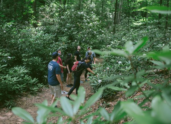
On-Site Trails
Andy Cove Nature Trail
Length: .6 mile loop
Difficulty: Easy
Surface: Rooty, with bridges, steps, and flat areas
Trailhead Location: At the parking lot of the Pisgah Visitor Center
Estimated Time: 30 – 60 minutes
Davidson River Exercise Trail
Length: 1.5-mile loop
Difficulty: Easy
Surface: Flat
Trailhead Location: Pisgah Visitor Center Parking Lot
Estimated Time: 30 – 60 minutes
This flat and scenic path follows the Davidson River with many fishing spots and resting areas along the way. The path also passes through the campground, which can be very busy with campers in the summer season.
Black Mountain Trail
Length: 10-mile out-and-back
Difficulty: Difficult
Surface: Rough terrain, rocky + rooty, and high elevated climbs
Trailhead Location: Near the Pisgah Visitor Center; you can take Black Mountain connector trails
Estimated Time: 5.5-6 hours
Estatoe Trail
Length: 2.8 miles out-and-back
Difficulty: Easy to easy-moderate
Surface: Paved trail with forest conditions
Trailhead Location: Either at the Visitor Center Parking Lot, Davidson River Parking Lot, or Lowes Parking Lot
Estimated Time: 30–60 minutes
The Estatoe Trail parallels the river on a nice and flat path. You can park at several locations to access this trail.
1. Visitor Center Parking Lot: Once parked, you may start on the ‘Exercise Path’ and cross the road, then continue walking the trail at the Art Loeb Trailhead.
2. Art Loeb Trailhead by the Davidson River Campground: Once parked, you may begin your walk on the flat path.
Nearby Trails Worth Adding to Your Visit
Note: Nearby trails are for informational purposes only and are not associated with, managed or maintained by FIND Outdoors
Pink Beds Loop
Length: About 5 miles for the full loop
Difficulty: Easy to moderate
Surface: Natural trail, old roadbed sections, footbridges, and bog bridges
Trailhead Location: Pink Beds parking area near US-276
Estimated Time: 2–3 hours
Pink Beds Loop is one of the best nearby options for visitors who want a longer but relatively gentle forest hike close to the Cradle. The trail has low elevation change compared with many mountain hikes in the area, making it a good choice for families and visitors who want more time outdoors without a steep climb.
Because Pink Beds is a natural trail, conditions can be wet or muddy, especially after rain. Visitors should wear comfortable hiking shoes and avoid describing this trail as accessible, even though it is considered one of the easier nearby hikes.
Moore Cove Falls
Length: About 0.7–0.75 mile one way
Difficulty: Easy to easy-moderate
Surface: Natural forest trail
Trailhead Location: Along US-276 South
Estimated Time: 30–60 minutes
Moore Cove Falls is a short waterfall hike that pairs well with a Cradle visit. The trail leads through the forest to a viewing area near the waterfall, making it a popular option for visitors who want a scenic stop without committing to a long hike.
This is a natural trail, not a paved walking path. Visitors should expect outdoor surfaces, possible mud, roots, rocks, and changing trail conditions. Use caution around waterfalls and avoid climbing on wet rocks or informal paths near the falls.
Graveyard Fields Loop and Second Falls
Length: About 1.2–1.3 miles for the main loop, with additional waterfall spur trails
Difficulty: Easy overall, with steeper sections near waterfall spurs
Surface: Mix of asphalt, steps, boardwalk-style sections, and natural trail
Trailhead Location: Graveyard Fields Overlook, Blue Ridge Parkway Milepost 418.8
Estimated Time: 1–2 hours
Graveyard Fields is one of the most popular trail areas near the Cradle for visitors heading onto the Blue Ridge Parkway. The area offers mountain scenery, streamside walking, and access to waterfalls, including Second Falls.
Visitors should plan ahead because parking can be limited during busy periods. Trail conditions may include mud, ruts, steps, steep sections, and confusing social trails. Stay on established trails, park only in designated areas, and allow extra time during peak seasons.