
Cradle of Forestry
On-site & Nearby Trails
Explore on-site paved Interpretive Trails and nearby hikes
The Cradle of Forestry offers short interpretive trails on site, along with access to longer hiking opportunities nearby in Pisgah National Forest and along the Blue Ridge Parkway. On-site trails are the best place to start if you want to combine forest history, paved walking routes, and time around the Discovery Center. Visitors looking for a longer outing can add nearby waterfall hikes, family-friendly forest loops, or more strenuous summit trails before or after their Cradle visit.
Trail mileage below uses published figures where available. Hiking times are general planning estimates only and may vary based on pace, weather, trail conditions, parking, and how often you stop along the way. Published trail distances can vary slightly by map source, route, and spur-trail choices, so the mileages below should be used as planning estimates.
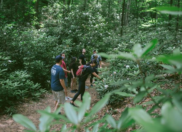
On-Site Trails at the Cradle
Biltmore Campus Trail
Length: 1 mile
Difficulty: Easy to easy-moderate
Surface: Paved trail with outdoor forest conditions
Trailhead Location: Near the Discovery Center and historic campus area
Estimated Time: 30–45 minutes
The Biltmore Campus Trail is a strong choice for visitors who want a shorter walk through the historic heart of the Cradle. This loop passes many of the site’s historic buildings and gives visitors a closer look at the places tied to the Biltmore Forest School and early forestry education in America.
Although the trail is paved, it is still located in a natural forest setting. Visitors may encounter leaves, roots, rocks, debris, inclines, turns, or changing surface conditions. Families, history lovers, and first-time visitors often find this trail to be one of the most meaningful ways to experience the Cradle.
Forest Festival Trail
Length: 1.3 miles
Difficulty: Easy to easy-moderate
Surface: Paved interpretive trail with outdoor forest conditions
Trailhead Location: Near the Discovery Center
Estimated Time: 40–60 minutes
The Forest Festival Trail begins near the Discovery Center and leads visitors toward several outdoor exhibits and visitor favorites. Along the way, you may see features such as the trout hatchery, historic road-building equipment (including early road graders used to shape and maintain forest roads), old homestead area, 1915 Climax logging locomotive, and portable sawmill.
This trail is a good option for visitors who want a longer on-site walk while still staying close to the main Cradle experience. The paved surface makes it more approachable than a rugged backcountry trail, but visitors should still be prepared for natural debris, grades, turns, and changing outdoor conditions.
Forest Discovery Trail
Length: 1.3 miles
Difficulty: Easy to easy-moderate
Surface: Paved trail with forest conditions
Trailhead Location: Branches from the Discovery Center area and loops through the wooded campus
Estimated Time: 40–60 minutes
The Forest Discovery Trail offers a quieter walk through the wooded side of the Cradle. This is a strong choice for visitors who want more time in the forest while still staying on an on-site trail connected to the main visitor area.
Like the other Cradle trails, the Forest Discovery Trail is paved but should not be treated like a smooth sidewalk. Trail conditions can change with weather, maintenance needs, leaves, roots, debris, and natural wear. Visitors using strollers, wheelchairs, walkers, or other mobility devices should assess current conditions before beginning the full route.
On-Site Trail Accessibility Note
The Discovery Center building is wheelchair friendly, and the Cradle offers paved walking trails with interpretive exhibits. However, the outdoor trails are located in a forest setting and may include roots, rocks, leaves, limbs, debris, inclines, drops, turns, and uneven or changing surfaces.
For this reason, visitors should think of the on-site routes as paved interpretive trails with variable outdoor conditions, not smooth indoor or sidewalk-style routes. Visitors with mobility concerns should review the Accessibility section and check current conditions before beginning a trail.
Nearby Trails Worth Adding to Your Visit
Note: Nearby trails are for informational purposes only and are not associated with, managed or maintained by FIND Outdoors
Pink Beds Loop
Length: About 5 miles for the full loop
Difficulty: Easy to moderate
Surface: Natural trail, old roadbed sections, footbridges, and bog bridges
Trailhead Location: Pink Beds parking area near US-276
Estimated Time: 2–3 hours
Pink Beds Loop is one of the best nearby options for visitors who want a longer but relatively gentle forest hike close to the Cradle. The trail has low elevation change compared with many mountain hikes in the area, making it a good choice for families and visitors who want more time outdoors without a steep climb.
Because Pink Beds is a natural trail, conditions can be wet or muddy, especially after rain. Visitors should wear comfortable hiking shoes and avoid describing this trail as accessible, even though it is considered one of the easier nearby hikes.
Moore Cove Falls
Length: About 0.7–0.75 mile one way
Difficulty: Easy to easy-moderate
Surface: Natural forest trail
Trailhead Location: Along US-276 South
Estimated Time: 30–60 minutes
Moore Cove Falls is a short waterfall hike that pairs well with a Cradle visit. The trail leads through the forest to a viewing area near the waterfall, making it a popular option for visitors who want a scenic stop without committing to a long hike.
This is a natural trail, not a paved walking path. Visitors should expect outdoor surfaces, possible mud, roots, rocks, and changing trail conditions. Use caution around waterfalls and avoid climbing on wet rocks or informal paths near the falls.
Graveyard Fields Loop and Second Falls
Length: About 1.2–1.3 miles for the main loop, with additional waterfall spur trails
Difficulty: Easy overall, with steeper sections near waterfall spurs
Surface: Mix of asphalt, steps, boardwalk-style sections, and natural trail
Trailhead Location: Graveyard Fields Overlook, Blue Ridge Parkway Milepost 418.8
Estimated Time: 1–2 hours
Graveyard Fields is one of the most popular trail areas near the Cradle for visitors heading onto the Blue Ridge Parkway. The area offers mountain scenery, streamside walking, and access to waterfalls, including Second Falls.
Visitors should plan ahead because parking can be limited during busy periods. Trail conditions may include mud, ruts, steps, steep sections, and confusing social trails. Stay on established trails, park only in designated areas, and allow extra time during peak seasons.
Looking Glass Rock Trail
Length: 3.1 miles one way
Difficulty: Moderate to strenuous
Surface: Natural mountain trail with switchbacks, roots, rocks, and steeper sections
Trailhead Location: Off Forest Service Road 475 near the Pisgah Center for Wildlife Education and Fish Hatchery area
Estimated Time: 3–5 hours
Looking Glass Rock Trail is a more strenuous nearby option for visitors who want a classic Pisgah National Forest hike. The trail climbs steadily with switchbacks and significant elevation gain, leading to wide views from the rock face.
This trail is best for prepared hikers who are comfortable with a longer climb, natural surfaces, and steeper grades. It is not recommended as a quick or easy add-on after a short Cradle visit.
Mount Pisgah Trail
Length: 1.6 miles to the summit
Difficulty: Moderate to strenuous
Surface: Natural mountain trail with steep and rocky sections
Trailhead Location: Mount Pisgah Parking Area on the Blue Ridge Parkway
Estimated Time: 1.5–3 hours
Mount Pisgah Trail is a short but challenging summit hike along the Blue Ridge Parkway. The upper portion of the trail becomes steeper and rockier, so visitors should not mistake the short mileage for an easy walk.
This is a good option for visitors who want a more active mountain hike with a summit-style experience. Wear appropriate footwear, bring water, and check weather and Parkway conditions before heading out.
Devils Courthouse Trail
Length: 0.5 mile one way to the summit
Difficulty: Strenuous
Surface: Steep natural and paved trail sections
Trailhead Location: Devils Courthouse Overlook, Blue Ridge Parkway Milepost 422
Estimated Time: 30–60 minutes
Devils Courthouse is one of the shortest nearby hikes by mileage, but it is steep and physically demanding. The trail leads from the overlook area to a summit viewpoint with long-range mountain views on clear days.
Visitors should stay on the designated trail, remain behind barriers at the summit, and follow all posted regulations. This trail is best for confident walkers who want a short challenge and a dramatic viewpoint.
Choosing the Right Trail for Your Visit
For the easiest on-site experience, start with the Biltmore Campus Trail or one of the paved interpretive trails near the Discovery Center. For a longer but still approachable nearby hike, consider Pink Beds Loop, Moore Cove Falls, or Graveyard Fields. For a more strenuous outing, Looking Glass Rock, Mount Pisgah, and Devils Courthouse offer steeper terrain and bigger mountain views.
Trail and road conditions can change quickly in the mountains. Before heading to nearby trails, check current weather, download maps if needed, and confirm Blue Ridge Parkway road status when traveling that direction.
For additional in-person planning help before exploring Pisgah National Forest, visitors can stop by the Pisgah Visitor Center for area information, restrooms, gifts, and forest-related resources.
→ View Cradle Trail Map
→ Check Blue Ridge Parkway Road Status