
Gladie Visitor Center
On-site & Nearby Trails
Explore Short Nature Walks, Gorge Trails, and Sandstone Landmarks
Gladie Visitor Center offers a convenient starting point for exploring the Red River Gorge and Daniel Boone National Forest. Visitors can begin with two short nature trails on the visitor-center grounds or travel a short distance to trails leading through forested valleys, around sandstone formations, and toward some of the Gorge’s best-known overlooks and natural arches.
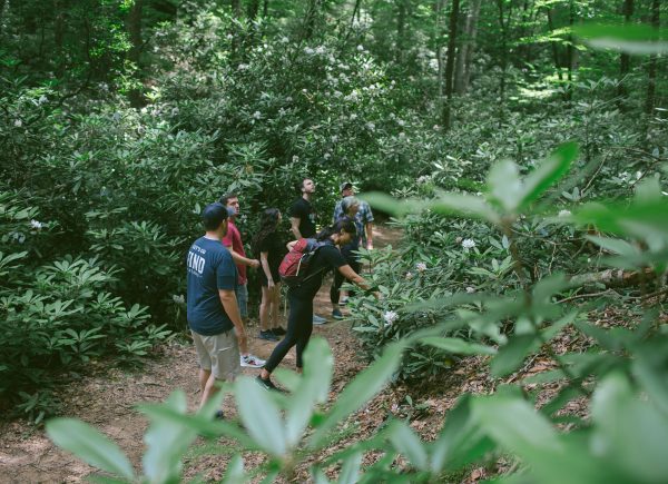
On-Site Trails at Gladie Visitor Center
Gladie Nature Trails
Length: Two short on-site walks; check the Gladie map or ask staff for current routing
Difficulty: Generally suitable for a brief, casual walk
Surface: Natural outdoor surfaces that may be uneven or muddy
Trailhead Location: Gladie Visitor Center grounds
Estimated Time: Approximately 15–45 minutes, depending on the route and pace
Two short nature trails begin at Gladie Visitor Center and offer an easier introduction to the forest, waterways, plants, wildlife habitat, and cultural landscape surrounding the site.
These trails are useful for families, visitors with limited time, and anyone who wants a brief walk without driving to a separate trailhead. They can also be combined with a visit to the interpretive exhibits and historic Gladie Cabin.
Conditions may change after rain or storms. Expect natural surfaces, fallen leaves, roots, mud, insects, and occasional trail maintenance. Remain on designated paths and ask Gladie staff about current conditions before beginning.
On-Site Trail and Mobility Note
The on-site trails at Gladie are short and less demanding than many backcountry trails in the Red River Gorge, but they are natural-surface trails and are not designed as accessible routes.
Due to the trails being in a natural setting, visitors should expect changing elevations and differing trail terrains including grass, gravel, roots, mud after rain, slopes, and other changing outdoor conditions. The trails should not be considered suitable for wheelchairs, scooters, walkers, strollers, or similar mobility devices.
Visitors with mobility concerns are encouraged to enjoy the accessible areas around the visitor center and speak with staff about current conditions before exploring outdoor portions of the site.
Nearby Trails Worth Adding to Your Visit
Note: Nearby trails are for informational purposes only and are not associated with, managed or maintained by FIND Outdoors
Bison Way Trail #210
Length: Approximately 0.4–0.5 mile one way
Difficulty: Moderate despite its short distance
Surface: Natural trail with grades, stairs, roots, and possible wet crossings
Trailhead Location: Along KY-715, immediately north of Gladie Visitor Center
Estimated Time: Approximately 30–60 minutes out and back
Bison Way is one of the closest established trails to Gladie. The trail climbs from KY-715 through the forest and connects with the Sheltowee Trace National Recreation Trail.
Although the route is short, visitors should expect a noticeable climb, uneven footing, and conditions that may become muddy or slippery after rain. This trail is a basic out-and-back route and is approximately one mile total with about 200 feet of ascent, stairs, and creek crossings.
Bison Way is also used to reach longer and more difficult backcountry routes. Visitors seeking only the short trail should turn around at the signed Sheltowee Trace connection rather than following unofficial routes toward Indian Staircase or other cliff areas.
Tower Rock Trail #229
Length: Approximately 0.5 mile one way
Difficulty: Moderate because of its climb and uneven terrain
Surface: Natural forest trail with steep sections, roots, rocks, and sandstone
Trailhead Location: Along KY-715 near Gladie Visitor Center
Estimated Time: Approximately 45–90 minutes round trip
Tower Rock Trail leads uphill toward the base of a prominent sandstone formation. The official trail is short, but the climb and natural footing can make it feel more demanding than the mileage suggests.
The trail provides a close look at the Gorge’s sandstone landscape but does not provide a maintained walking route to the top of Tower Rock. Visitors should remain on the established trail and avoid climbing the formation.
Parking near the trailhead is limited and may consist of small roadside pull-offs. Do not block the roadway, private access, or other vehicles.
Sky Bridge Trail #214
Length: Approximately 1 mile
Difficulty: Moderate
Surface: Developed and natural trail with stairs and uneven areas
Trailhead Location: Sky Bridge Recreation Area
Estimated Time: Approximately 45–90 minutes
Sky Bridge Trail forms a short route around one of the Red River Gorge’s most recognizable natural arches. Visitors can experience views from above the formation and follow the trail beneath the sandstone bridge.
The trail includes stairs, changes in grade, and areas close to steep drop-offs. Keep children close, keep pets under control, and avoid approaching cliff edges. Wet leaves, ice, and rain can make the rock and steps slippery.
Sky Bridge Recreation Area is reached by a separate drive from Gladie and has its own parking area and visitor conditions.
Chimney Top Trail #235
Length: Approximately 0.3 mile one way
Difficulty: Short and generally less strenuous, but with serious cliff hazards
Surface: Developed and natural walking surfaces
Trailhead Location: Chimney Top Recreation Area
Estimated Time: Approximately 30–60 minutes round trip
Chimney Top Trail is a short walk leading to a dramatic overlook above the Red River Gorge. The route involves less distance and climbing than many nearby trails, making it a useful option for visitors looking for a brief scenic stop.
The overlook is located beside steep cliffs. Stay behind barriers, use caution around cliff edges, supervise children closely, keep pets leashed, and never climb around fences or leave the designated viewing area. Fog, rain, ice, and wet leaves can increase the risk of slipping.
Original Trail to Natural Bridge
Length: Approximately 0.5 mile one way
Difficulty: Moderate
Surface: Gravel and natural surfaces with stairs
Trailhead Location: Hemlock Lodge area at Natural Bridge State Resort Park
Estimated Time: Approximately 1–2 hours round trip, including time at the bridge
The Original Trail provides one of the most direct hiking routes to Natural Bridge. The trail climbs approximately 500 feet from the lodge area through a forested sandstone landscape and passes historic Civilian Conservation Corps features.
Although the trail is only about half a mile each way, the sustained climb and steps can make it challenging. Visitors should wear secure footwear, carry water, and allow time for breaks.
Natural Bridge State Resort Park is managed separately from the Red River Gorge Geological Area. Most park trails are within a state nature preserve where pets are not permitted, so visitors traveling with a dog should review the current park rules before arriving.
Choosing the Right Trail for Your Visit
The nearby trails described above are natural or partially developed hiking routes and should not be assumed to be wheelchair accessible. Bison Way and Tower Rock include elevation changes and uneven terrain, while Sky Bridge, Chimney Top, and the Original Trail may include stairs, slopes, or exposed areas.
For the shortest on-site experience, choose one of the two nature trails at Gladie Visitor Center. These walks are best for visitors who want a brief introduction to the area without driving to another trailhead.
Bison Way and Tower Rock are among the closest established Forest Service trails, but both include natural terrain and climbing. Sky Bridge offers a short natural-arch experience with stairs and cliff exposure, while Chimney Top provides a brief walk to a dramatic overlook.
For visitors prepared for a sustained uphill climb, the Original Trail at Natural Bridge State Resort Park leads to one of the region’s best-known sandstone landmarks.
Before beginning any trail, check current weather, road conditions, parking information, and managing-agency alerts. Save maps offline, carry water, allow enough daylight, and select a route that fits your group’s experience, available time, and comfort around steep terrain.
→ View the Gladie Visitor Center Map
→ Explore Red River Gorge Maps
→ View Current Gladie Visitor Information
→ Check Daniel Boone National Forest Alerts
→ Explore Natural Bridge State Resort Park Trails